Underground Water Detection Service
Our Electromagnetic (TT/MN) Device boasts a meticulously designed multi-stage signal conditioning system, achieving unprecedented measurement accuracy and reliability, underpinning your water exploration endeavors.
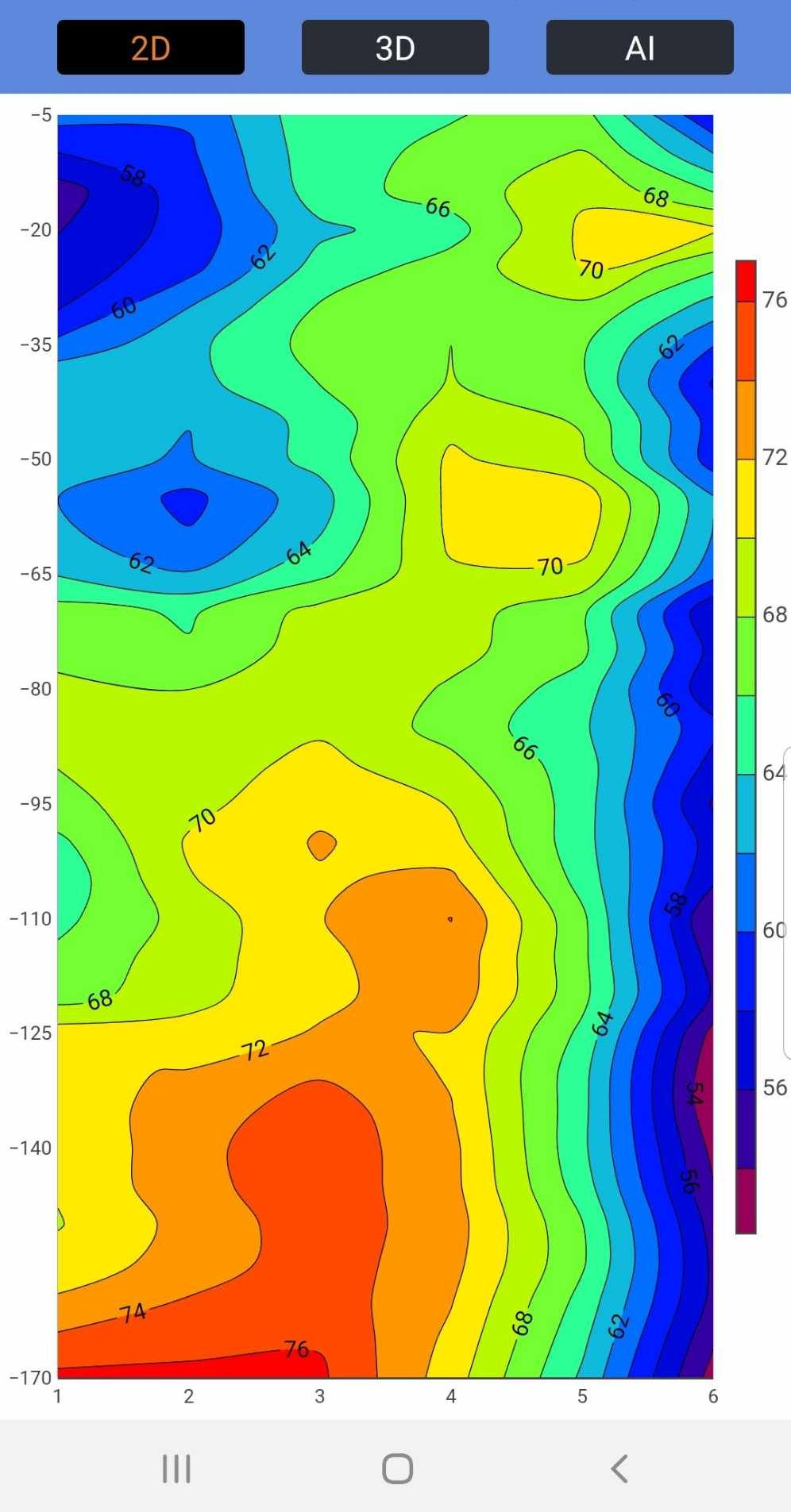
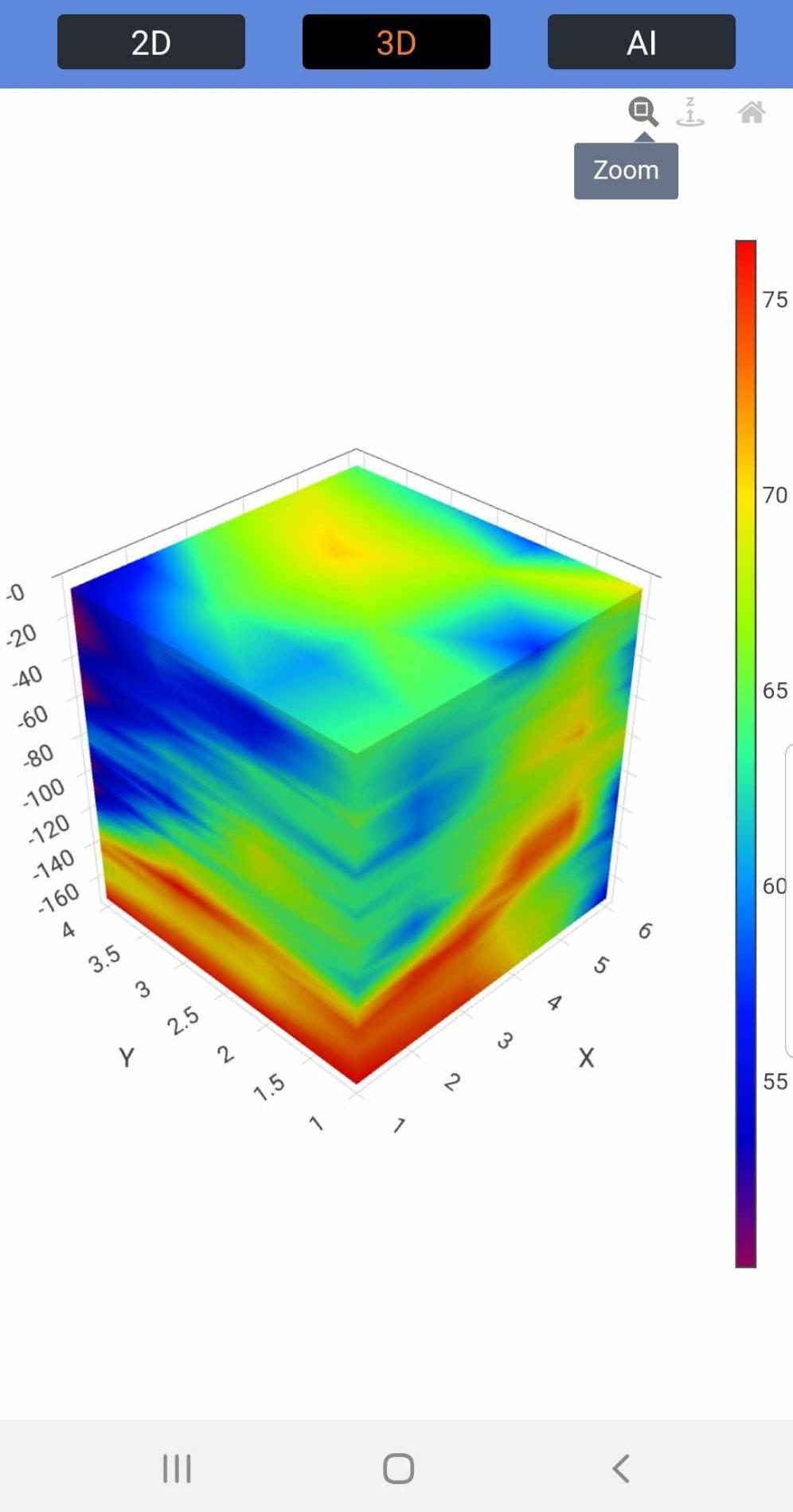
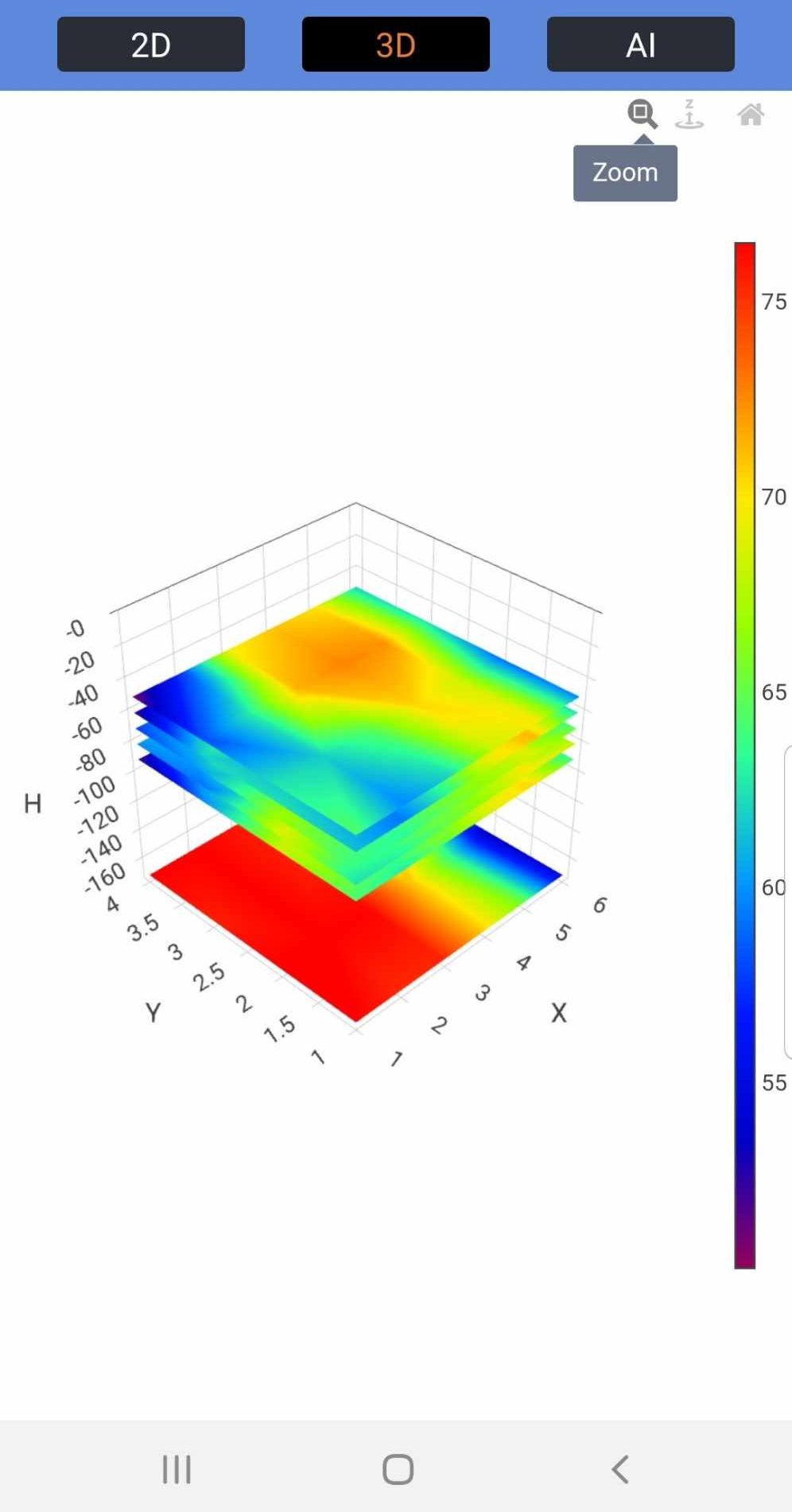
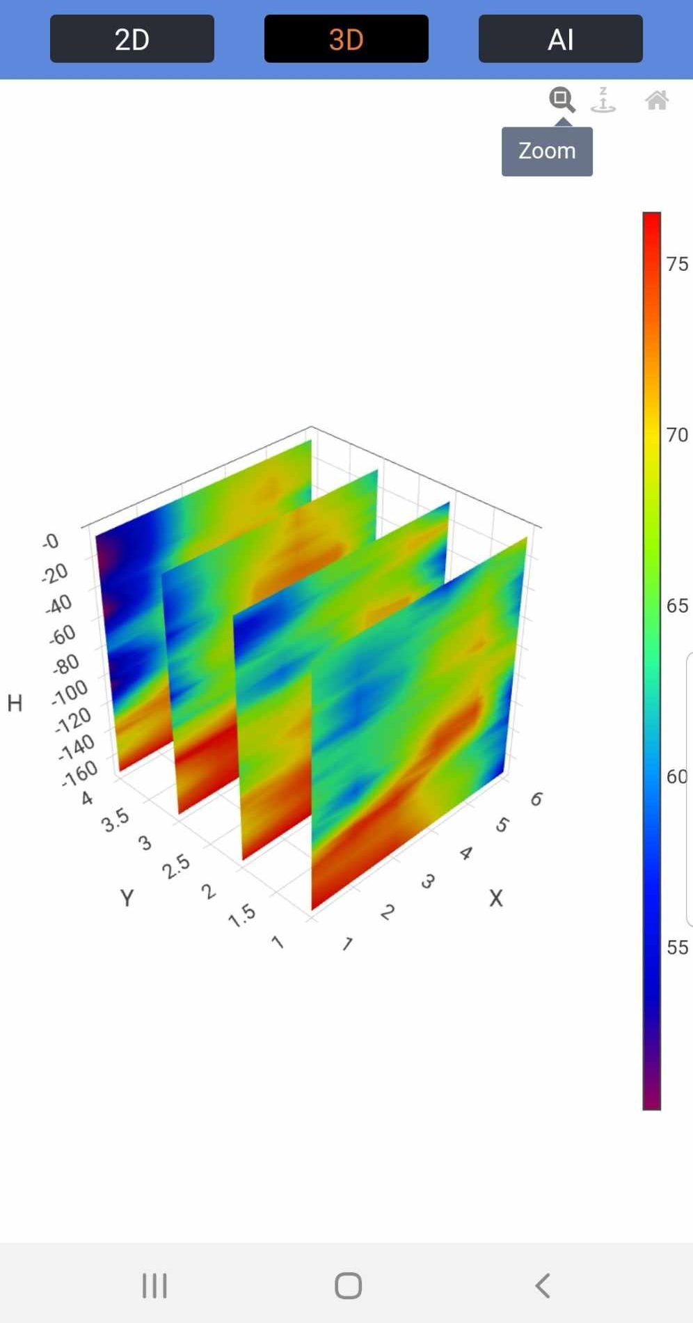
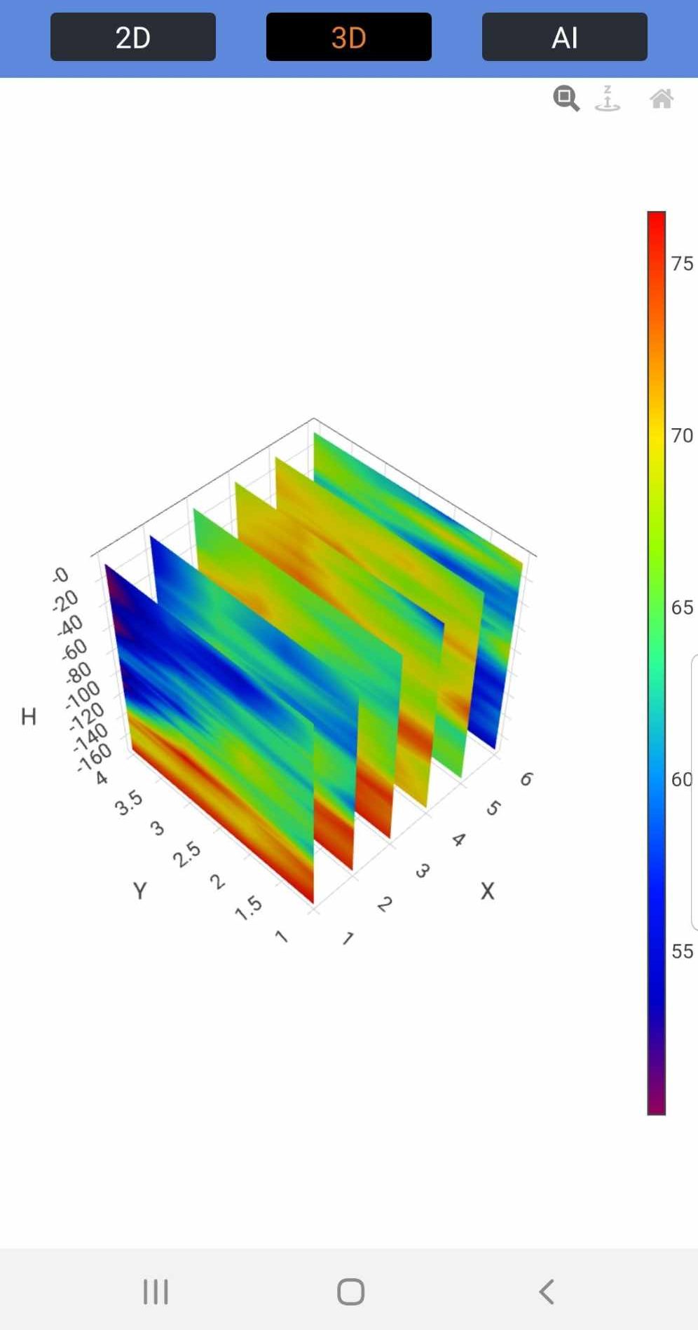
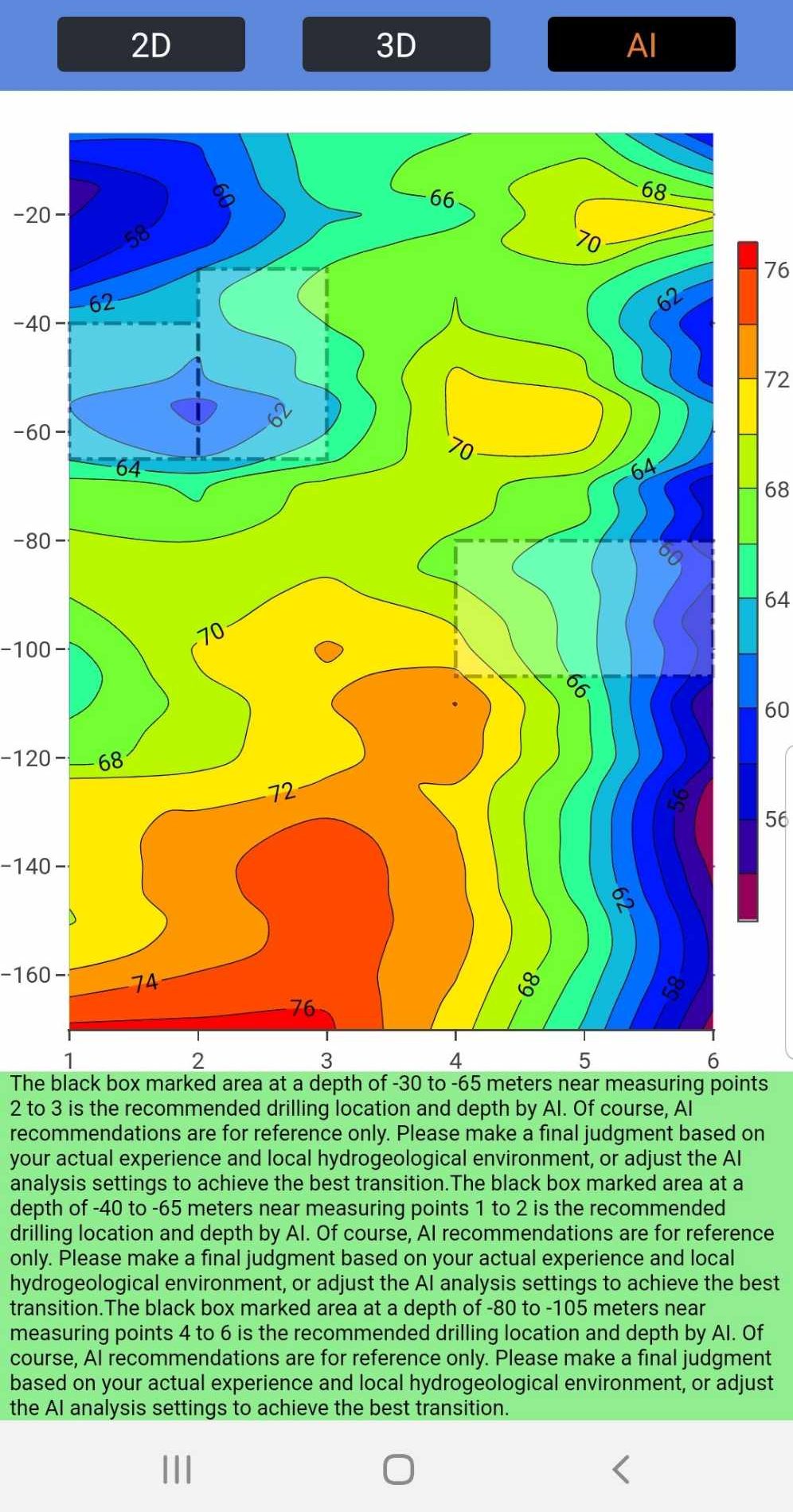
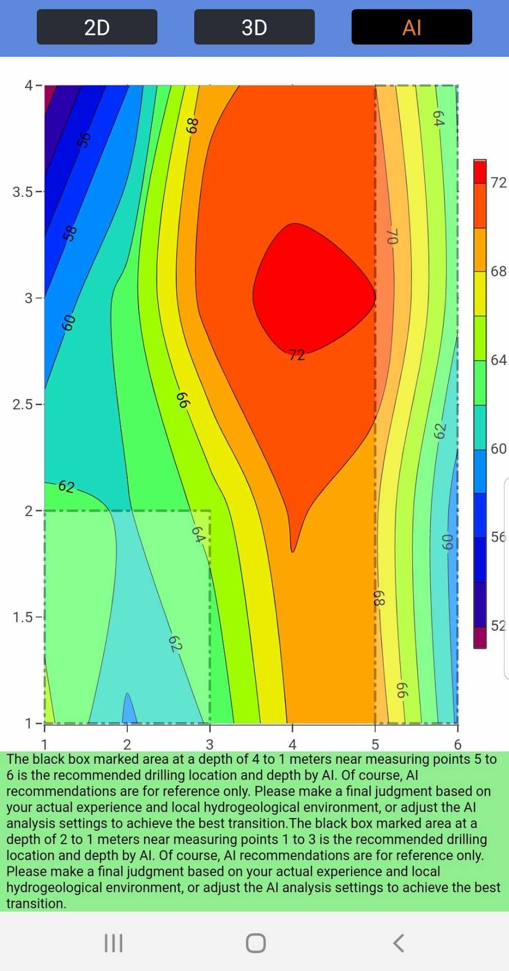
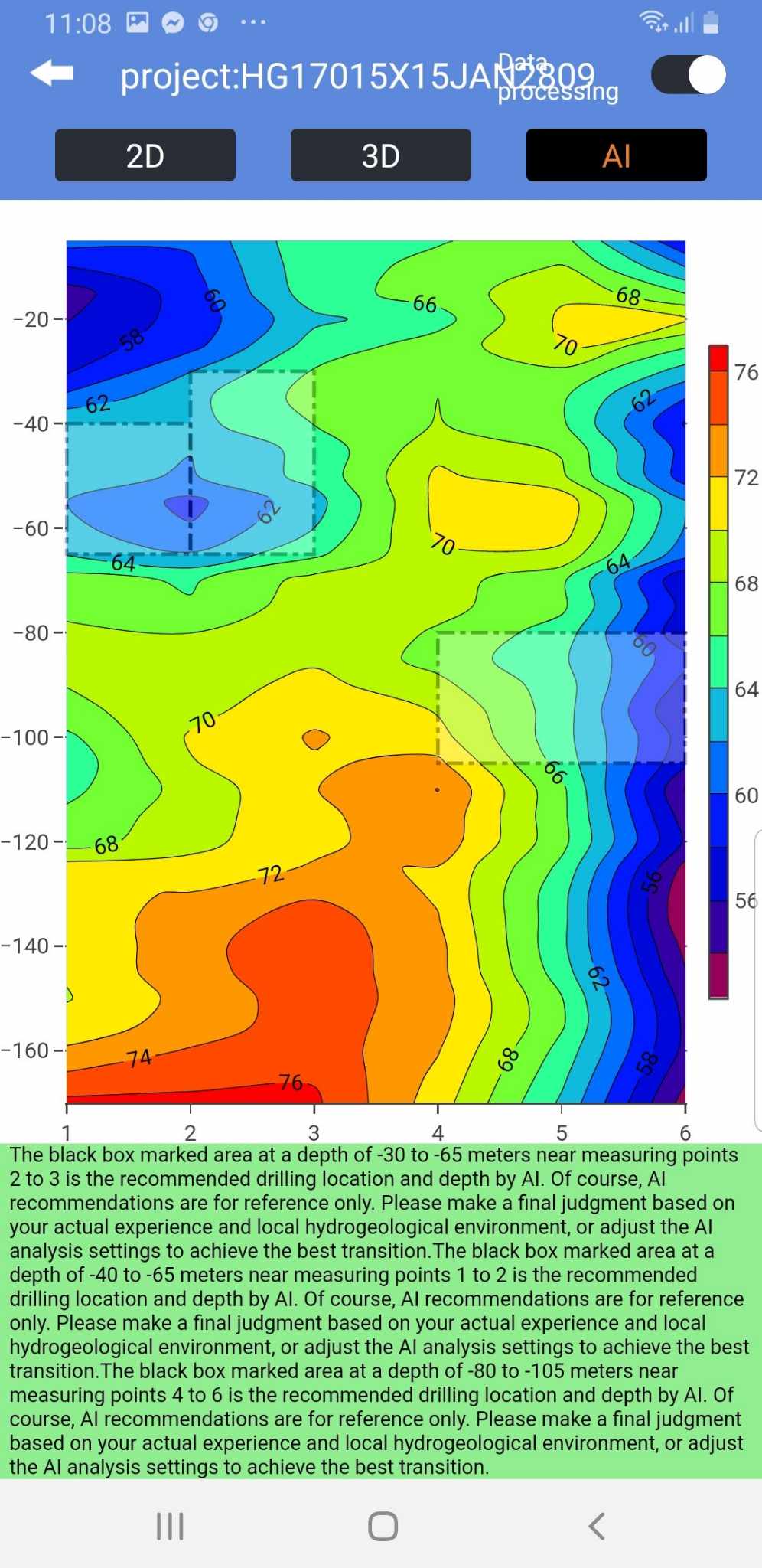
Our device can scan and survey the underground from 0 to 300 meters (0 – 985 feet) in depth. It operates with a line and column spacing of 1 to 5 meters (3 to 16 feet), where the intersections represent the data point locations.
our services
We Give A Comprehensive Water Detection Service
We provide you with detailed colored maps of the underground survey results, generated by our Electromagnetic (TT/MN) device. Furthermore, you receive a digital copy of the survey data. This data can be used for live and animated viewing on your preferred Android devices using Water Detection Apps or uploaded online for data analysis.
FAQ
do you have a question?
We would be delighted to discuss your water supply needs and requirements with you.